Indralaya
District indonésien
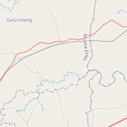
Indralaya is a town and also an administrative district (kecamatan). The town serves as the capital of Ogan Ilir Regency in South Sumatra Province of Indonesia. This town is a satellite community of Palembang city at a distance of 31 km.
Nº Q4197374 ★★★
Rare · Lieux
Indralaya
District indonésien
Indralaya is a town and also an administrative district (kecamatan). The town serves as the capital of Ogan Ilir Regency in South Sumatra Province of Indonesia. This town is a satellite community of Palembang city at a distance of 31 km.
Sur la carte


Dernier prix
—
Prix plancher
—
Médiane 7 j
—
Ventes 30 j
0
Fourchette 30 j
—
En circulation
0
Cours
médiane
min – max
ventes
Aucune vente sur la période
Voir le tableau
| Date | médiane | Min | Max | ventes |
|---|
Historique des ventes
- Dernière vente
- —
- Moyenne 30 j
- —
- Plus bas 30 j
- —
- Plus haut 30 j
- —
- Ventes 7 j
- 0
- Ventes 30 j
- 0
Aucune vente pour l'instant.
Ventes anonymes : ni acheteur ni vendeur. Les chiffres ne comptent que les ventes entre joueurs.
Sur Wikipédia
Texte en anglais Pas encore d'article dans ta langue : extrait en anglais.
Indralaya is a town and also an administrative district (kecamatan). The town serves as the capital of Ogan Ilir Regency in South Sumatra Province of Indonesia. This town is a satellite community of Palembang city at a distance of 31 km. Indralaya is also part of the Palembang metropolitan area, which was designed by the central government to create the 10 New Jakarta areas. This is also in line with the construction of the inner city Palembang–Indralaya (Palindra) Toll Road, which shortens the distance between Palembang and Indralaya, especially for easy access for Sriwijaya University students. The area of Indralaya District is 101.22 km2 which is divided into 17 rural villages (desa) and 3 urban villages (kelurahan); the latter - Indralaya Indah, Indralaya Mulya and Indralaya Raya - form the town and together cover 11.65 km2 and had a combined population of 15,238 as at mid 2024. The villages with the largest area in the district are Sejaro Sakti desa with an area of 19.57 km2 and Tanjung Seteko desa with an area of 13.44 km2, while the village with the smallest area is Muara Penimbung Ulu desa with an area of 0.84 km2. Indralaya District contains 74 hamlets and 144 neighborhood associations (RT). The city is also crossed by the Trans-Sumatra Highway and the Trans-Sumatra Toll Road, the Palembang-Indralaya section and the Indralaya-Prabumulih Intersection section.
Texte : Wikipédia en anglais, CC BY-SA 4.0. ·
Cartes voisines
Indralaya Utara
District indonésien
Nº Q10370995 ★★

Palembang metropolitan area
Metropolitan area in South Sumatra, Indonesia
Nº Q56391911 ★★★

Palembang–Indralaya Toll Road
Toll Road in Indonesia
Nº Q25461893 ★★★

Ogan Ilir
Kabupaten de la province de Sumatra du Sud
Nº Q8122 ★★★★

Indragiri Hilir
Régence de la province de Riau en Indonésie
Nº Q7599 ★★★★★

Tembilahan
District indonésien
Nº Q6542770 ★★★★