

Común · Lugares
Arros
Río de Francia
The Arros (French pronunciation: [aʁɔs]; Occitan: Arròs) is a right tributary of the Adour, in the Southwest of France. It is 130.2 km (80.9 mi) long.
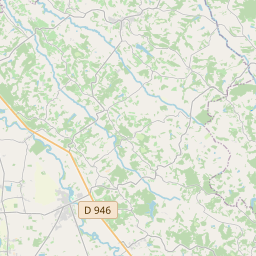
En el mapa

En Wikipedia
Texto en inglés Aún no hay artículo en tu idioma: extracto en inglés.
The Arros (French pronunciation: [aʁɔs]; Occitan: Arròs) is a right tributary of the Adour, in the Southwest of France. It is 130.2 km (80.9 mi) long. The name Arros is based on the root Arr- 'stone' and the suffix -os. The Arros rises in the Baronnies of Pyrenees, southeast of Bagnères-de-Bigorre, below the Signal de Bassia (1 921 m). It flows north through a narrow valley defended by the castle of Mauvezin and the bastide of Tournay. It joins the Adour before it turn west, upstream from Riscle.
Texto: Wikipedia en inglés, CC BY-SA 4.0. · Imagen: Jean-Noël Lafargue (Jean-no) (FAL) ·