Sa'ir
Municipality in Hebron Governorate
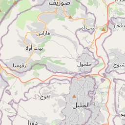
Sa'ir (Arabic: سعير, also spelled Saeer, Seir, or Si'ir) is a Palestinian town in the Hebron Governorate of the State of Palestine, in the southern West Bank, located 8 kilometers (5.0 mi) northeast of Hebron. Nearby localities include Beit Fajjar and al-Arroub to the north, Beit Ummar to the northwest, Halhul to the west and Beit Einun and ash-Shuyukh to the south.
Nº Q7395443 ★★★★
Super Rare · Places
Sa'ir
Municipality in Hebron Governorate
Sa'ir (Arabic: سعير, also spelled Saeer, Seir, or Si'ir) is a Palestinian town in the Hebron Governorate of the State of Palestine, in the southern West Bank, located 8 kilometers (5.0 mi) northeast of Hebron. Nearby localities include Beit Fajjar and al-Arroub to the north, Beit Ummar to the northwest, Halhul to the west and Beit Einun and ash-Shuyukh to the south.
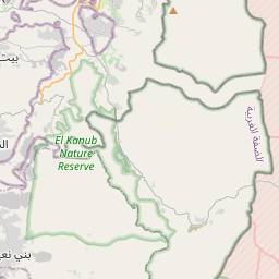
On the map
Last price
—
Floor price
—
7-day median
—
30-day sales
0
30-day range
—
In circulation
0
Price history
median
low – high
sales
No sales in this period
Show table
| Date | median | Low | High | sales |
|---|
Sales history
- Last sale
- —
- 30-day average
- —
- 30-day low
- —
- 30-day high
- —
- Sales 7d
- 0
- Sales 30d
- 0
No sales yet.
Anonymous sales: no buyer or seller shown. Figures count player-to-player sales only.
From Wikipedia
Sa'ir (Arabic: سعير, also spelled Saeer, Seir, or Si'ir) is a Palestinian town in the Hebron Governorate of the State of Palestine, in the southern West Bank, located 8 kilometers (5.0 mi) northeast of Hebron. Nearby localities include Beit Fajjar and al-Arroub to the north, Beit Ummar to the northwest, Halhul to the west and Beit Einun and ash-Shuyukh to the south. The Dead Sea is just east of Sa'ir's municipal borders. In the 2017 census Palestinian Central Bureau of Statistics, the town had a population of 20,722. It has municipal jurisdiction over 117,000 dunams, 6,000 of which is built-up area and 11,715 of which is cultivated. The main economic activities in Sa'ir are agriculture and the Israeli labor market, although the latter has been adversely affected as a result of the Israeli restrictions following the Second Intifada in 2000–04. Olives are the major cash crop.
Text: Wikipédia, CC BY-SA 4.0. ·
Related cards

Hebron Governorate
Governorate of the Palestinian National Authority
Nº Q264180 ★

Beit Ummar
Municipality in Hebron Governorate
Nº Q2893117 ★★★

Beit Sahour
Palestinian city in the occupied West Bank
Nº Q803990 ★

Surif
City in Palestine
Nº Q2898863 ★★★

Idna
Municipality in Hebron Governorate
Nº Q2919205 ★★★

Sajur
Druze Arab village in northern Israel
Nº Q732433 ★★★★★