
Manaslu
Mountain in Nepal; eighth highest mountain in the world
Manaslu (; Nepali: मनास्लु, also known as Kutang) is the eighth-highest mountain in the world at 8,163 metres (26,781 ft) above sea level. It is in the Mansiri Himal, part of the Nepalese Himalayas, in west-central Nepal.
Nº Q170070 ★★★★
Super Rare · Places
Manaslu
Mountain in Nepal; eighth highest mountain in the world
Manaslu (; Nepali: मनास्लु, also known as Kutang) is the eighth-highest mountain in the world at 8,163 metres (26,781 ft) above sea level. It is in the Mansiri Himal, part of the Nepalese Himalayas, in west-central Nepal.
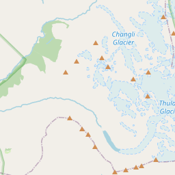
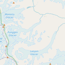
On the map
Last price
—
Floor price
—
7-day median
—
30-day sales
0
30-day range
—
In circulation
0
Price history
median
low – high
sales
No sales in this period
Show table
| Date | median | Low | High | sales |
|---|
Sales history
- Last sale
- —
- 30-day average
- —
- 30-day low
- —
- 30-day high
- —
- Sales 7d
- 0
- Sales 30d
- 0
No sales yet.
Anonymous sales: no buyer or seller shown. Figures count player-to-player sales only.
From Wikipedia
Manaslu (; Nepali: मनास्लु, also known as Kutang) is the eighth-highest mountain in the world at 8,163 metres (26,781 ft) above sea level. It is in the Mansiri Himal, part of the Nepalese Himalayas, in west-central Nepal. Manaslu means "mountain of the spirit" and the word is derived from the Sanskrit word manasa, meaning "intellect" or "soul". Manaslu was first climbed on May 9, 1956, by Toshio Imanishi and Gyalzen Norbu, members of a Japanese expedition. Manaslu is the highest peak in the Gorkha District and is about 64 km (40 mi) east of Annapurna, the tenth highest mountain in the world at 8,091 metres (26,545 ft) above sea level. Manaslu's long ridges and valley glaciers offer feasible approaches from all directions and culminate in a peak that towers steeply above its surrounding landscape and is a dominant feature when viewed from afar. The Manaslu region offers a variety of trekking options. The popular Manaslu trekking route of 177 kilometres (110 mi) skirts the Manaslu massif over the pass down to Annapurna. The Nepalese Government only permitted trekking on this circuit in 1991. The trekking trail follows an ancient salt-trading route along the Budhi Gandaki River. En route, 10 peaks over 6,500 metres (21,325 ft) are visible, including a few over 7,000 metres (22,966 ft). The highest point reached along the trek route is Larkya La at an elevation of 5,106 metres (16,752 ft). As of May 2008, the mountain has been climbed 297 times with 53 fatalities. The Manaslu Conservation Area Project (MCAP) was established in 1997 with the primary objective of achieving conservation and sustainable management of the delimited area, which also includes Manaslu.
Text: Wikipédia, CC BY-SA 4.0. · Image: Pratapgrg (CC BY-SA 4.0) ·
Related cards

Makalu
Mountain in Nepal/China; 5th highest in the world
Nº Q169986 ★★★★

Mahalangur Himal
The highest mountain range in the world in the Himalayas on the border between Nepal and Tibet
Nº Q924257 ★★

Cho Oyu
Mountain in Nepal/China
Nº Q170089 ★★★★

Meru Peak
Mountain
Nº Q2586260 ★★

South Col
Col between Mount Everest and Lhotse
Nº Q2598195 ★★★

Gaurishankar
Mountain in Nepal and Tibet
Nº Q1496289 ★