

Uncommon · Places
Dunstable
Market town and civil parish located in Bedfordshire, England
Dunstable ( DUN-stə-bəl) is a market town and civil parish in Bedfordshire, England, east of the Chiltern Hills, 30 miles (50 kilometres) north of London. There are several steep chalk escarpments, most noticeable when approaching Dunstable from the north.
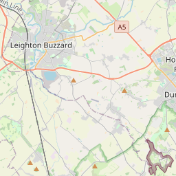
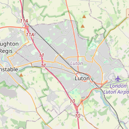
On the map
From Wikipedia
Dunstable (/ˈdʌnstəbəl/ DUN-stə-bəl) is a market town and civil parish in Bedfordshire, England, east of the Chiltern Hills, 30 miles (50 kilometres) north of London. There are several steep chalk escarpments, most noticeable when approaching Dunstable from the north. Dunstable is the fourth largest town in Bedfordshire and along with Houghton Regis forms the westernmost part of the Luton/Dunstable urban area. In Roman times there was a minor settlement called Durocobrivis in the area now occupied by modern-day Dunstable. There was a general assumption that the nominative form of the name had been Durocobrivae, so that is what appears on the map of 1944 illustrated below. But current thinking is that the form Durocobrivis, which occurs in the Antonine Itinerary, is a fossilised locative that was used all the time and Ordnance Survey now uses this form. There are several theories concerning its modern name: Relics of Palæolithic humans, including such relics as flint implements and the bones of contemporary wild animals, suggest the settlement is prehistoric. Traces of Neolithic activity are not in doubt but much of their mystery may be lost under the surrounding Chiltern Hills. At Maiden Bower in the parish of Houghton Regis to the north, there is an Iron Age hill fort, which is clearly marked on the Ordnance survey maps. Maiden Bower has some of the ramparts showing through the edge of an old chalk quarry at Sewell where remains of an older Bronze Age fort exist.
Text: Wikipédia, CC BY-SA 4.0. · Image: Nigel Cox (CC BY-SA 2.0) ·